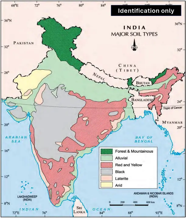
Map Items
- Major Soil Types
Map Items
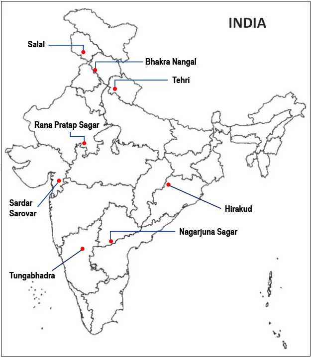
Dams
- Salal (Chenab – Jammu & Kashmir)
- Bhakra Nangal (Sutlej – Himachal Pradesh)
- Tehri (Bhagirathi – Uttarakhand)
- Rana Pratap Sagar (Chambal – Rajasthan)
- Sardar Sarovar (Narmada – Gujrat)
- Hirakud (Mahanadi – Orissa)
- Nagarjuna Sagar (Krishna – Telangana)
- Tungabhadra Sagar (Tungabhadra – Karnataka)
Map Items
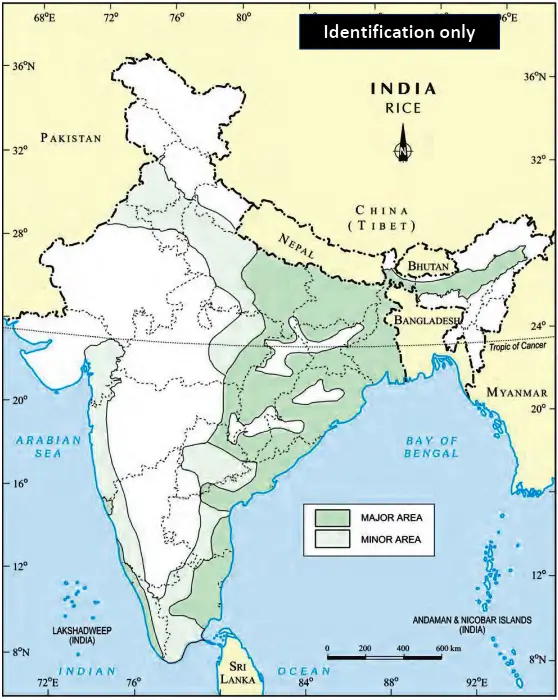
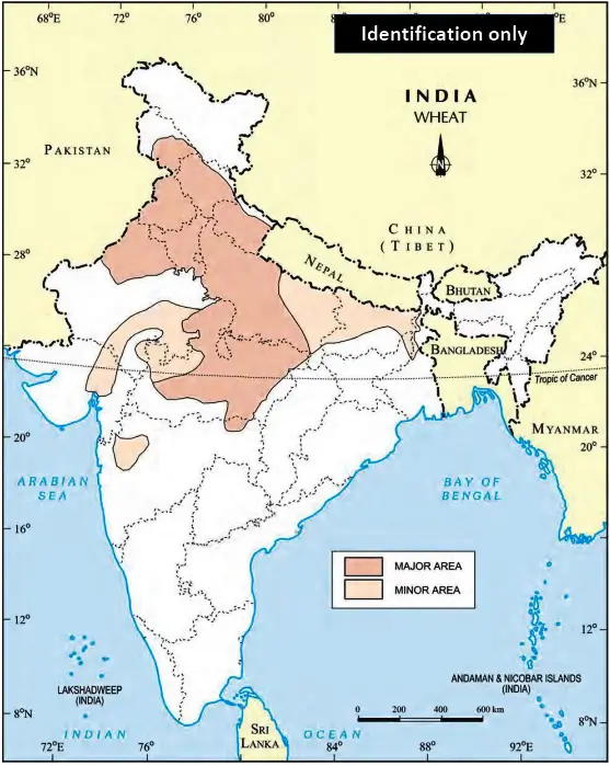
Major areas of Rice and Wheat
- Rice
- Wheat
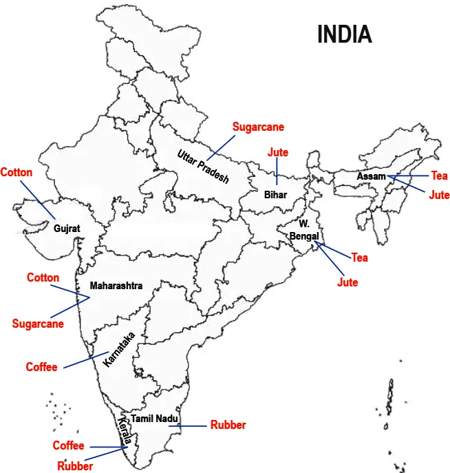
Largest/Major producer states of Sugarcane, Tea, Coffee, Rubber, Cotton and Jute:
- Sugarcane: Uttar Pradesh, Maharashtra
- Tea: Assam, W. Bengal
- Coffee: Karnataka, Kerala
- Rubber: Kerala, Tamil Nadu
- Cotton: Maharashtra, Gujrat
- Jute: W. Bengal, Bihar, Assam
Map Items
Minerals (identification only)
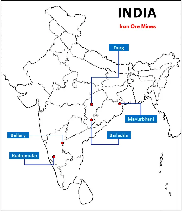
Iron Ore Mines
- Mayurbhanj (Odisha)
- Durg (Chhattisgarh)
- Bailadila (Chhattisgarh)
- Bellary (Karnataka)
- Kudremukh (Karnataka)
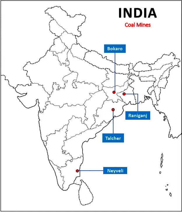
- Bokaro (Jharkhand)
- Raniganj (W. Bengal)
- Talcher (Odisha)
- Neyveli (Tamil Nadu)
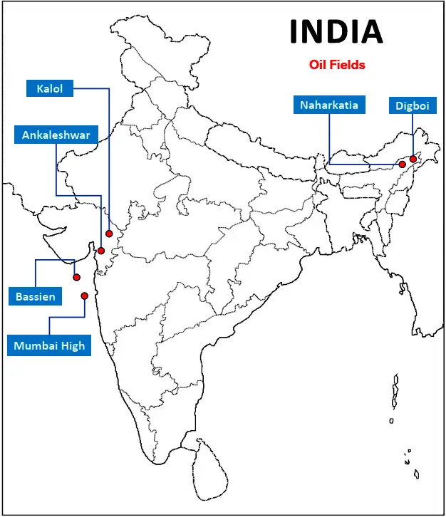
- Digboi (Assam)
- Naharkatia (Assam)
- Mumbai High (Maharashtra)
- Bassien (Maharashtra)
- Kalol (Gujarat)
- Ankleshwar (Gujarat)
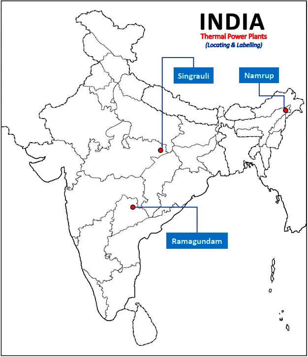
Thermal
- Singrauli (Madhya Pradesh)
- Ramagundam (Telangana)
- Namrup (Assam)
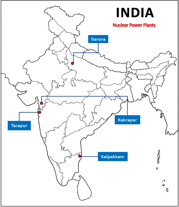
- Narora (Uttar Pradesh)
- Kakrapar (Gujarat)
- Tarapur (Maharashtra)
- Kalpakkam (Tamil Nadu)
Map Items
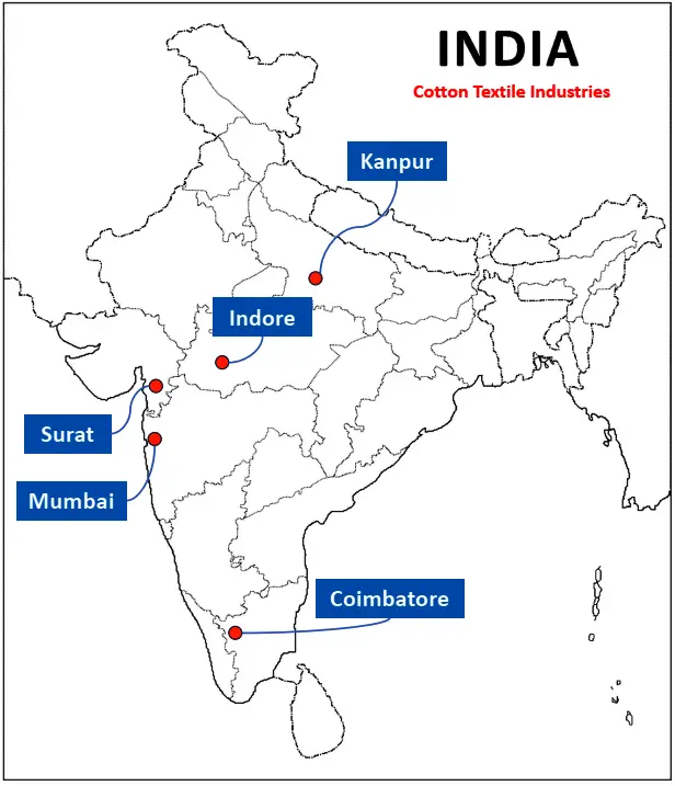
Cotton Textile Industries
(Locating & Labelling/Identification)
- Mumbai (Maharashtra)
- Indore (Madhya Pradesh)
- Surat (Gujarat)
- Kanpur (Uttar Pradesh)
- Coimbatore (Tamil Nadu)
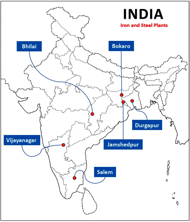
(Locating & Labelling/Identification)
- Durgapur (W. Bengal)
- Bokaro (Jharkhand)
- Jamshedpur (Jharkhand)
- Bhilai (Chhattisgarh)
- Vijayanagar (Karnataka)
- Salem (Tamil Nadu)
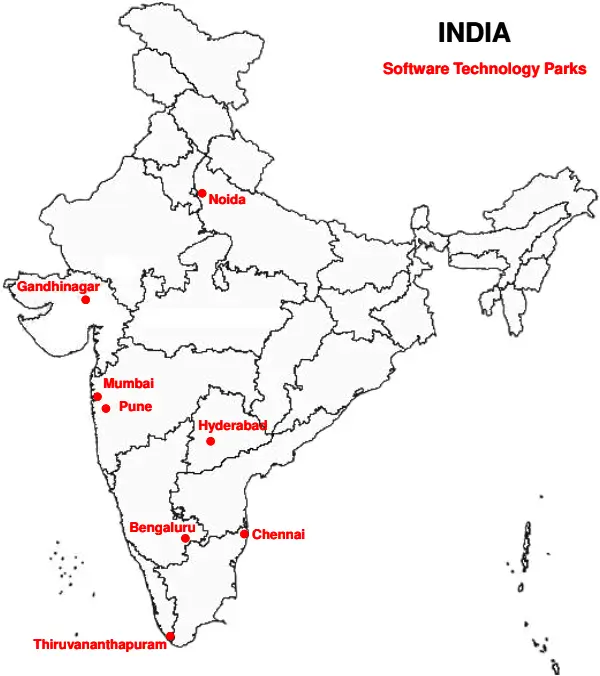
(Locating and labelling only)
- Noida (Uttar Pradesh)
- Gandhinagar (Gujarat)
- Mumbai (Maharashtra)
- Pune (Maharashtra)
- Hyderabad (Telangana)
- Bengaluru (Karnataka)
- Chennai (Tamil Nadu)
- Thiruvananthapuram (Kerala)
Map Items
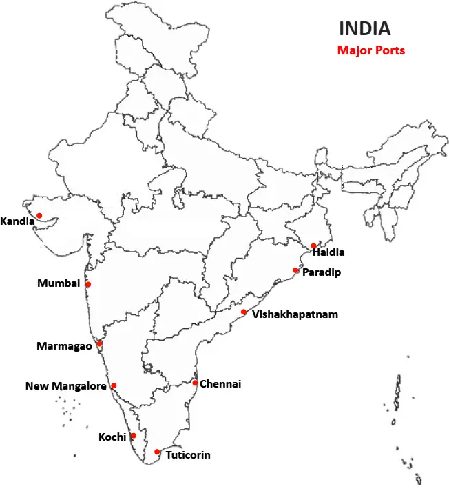
Major Ports
- Kandla
- Mumbai
- Marmagao
- New Mangalore
- Kochi
- Tuticorin
- Chennai
- Vishakhapatnam
- Paradip
- Haldia
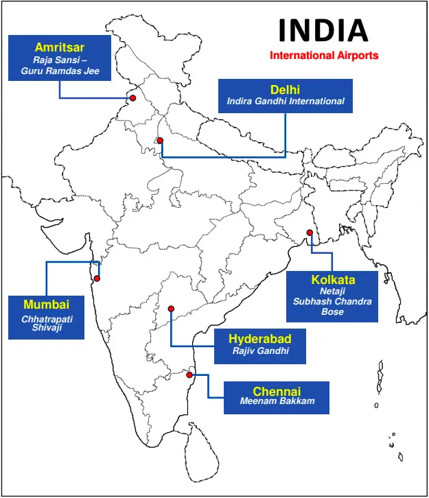
- Amritsar (Raja Sansi – Guru Ramdas Jee)
- Delhi (Indira Gandhi)
- Mumbai (Chhatrapati Shivaji)
- Chennai (Meenam Bakkam)
- Kolkata (Netaji Subhash Chandra Bose)
- Hyderabad (Rajiv Gandhi)